Hamiltonban Township Plans & Maps
Hamiltonban Township Plans & Maps
Plans
The following documents describe the long-term planning goals of the Township.
Hamiltonban Township Planning Documents
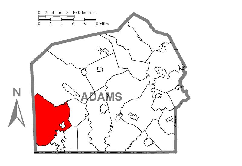
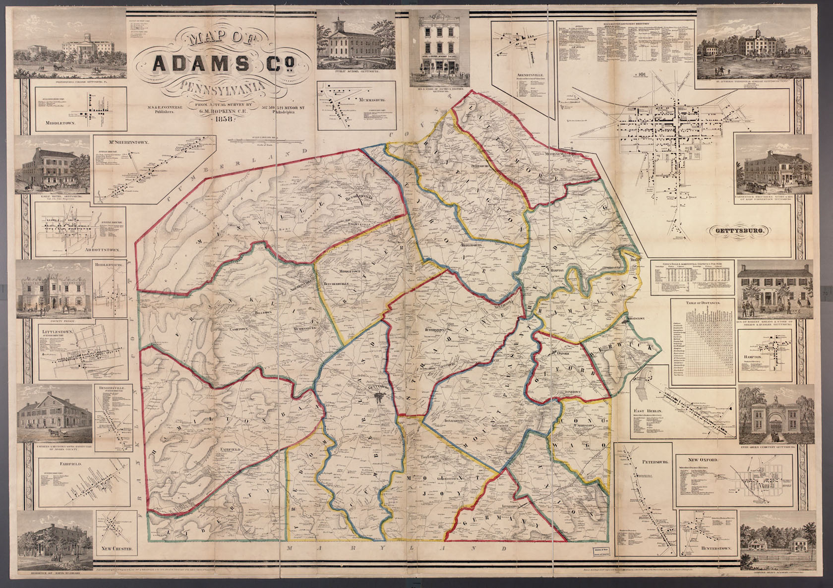
- Adams County Map Highlighting Hamiltonban Township
- Daily Traffic Volumes Map (1988)
- GG-Plate 1:100-Yr Flood Plain, Mapped Wetlands, Woodland, 20%+ Slopes
- GG-Plate 2: Soils, Natural Areas, Michaux State Forest
- GG-Plate 3: Agricultural Security Areas, Settled Easements, Land Conservancy Areas
- GG-Plate 4: Historic Sites
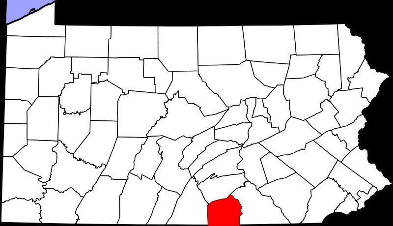
- Pennsylvania Map Highlighting Adams County
- Public Roads And Private Lanes (2008)
- Public Roads, Private Lanes, And Property Boundaries (2008)
- Public Roads, Railroads, And Streams (2006)
- Roadway Classification Map (1991)
- Roadway Jurisdiction Map (1991)
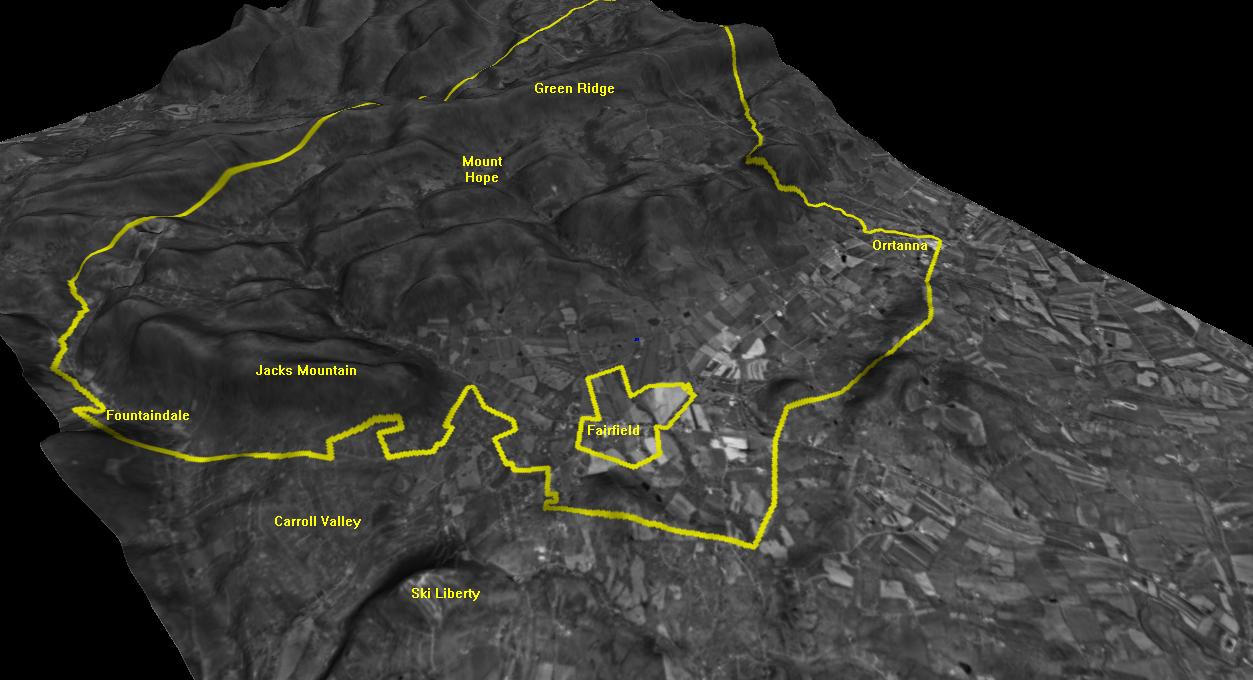
- Three-Dimensional Relief Map
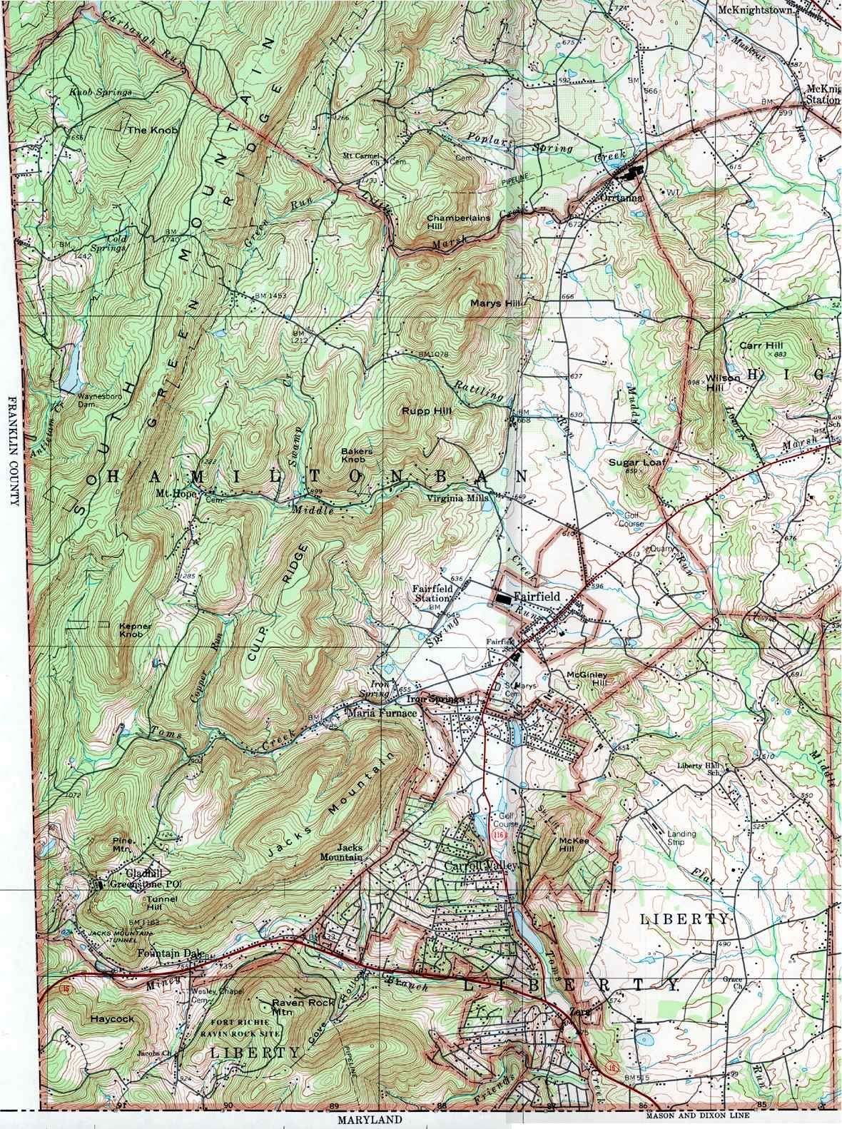
- Topographic Map (1994)
- Wetlands (1991)
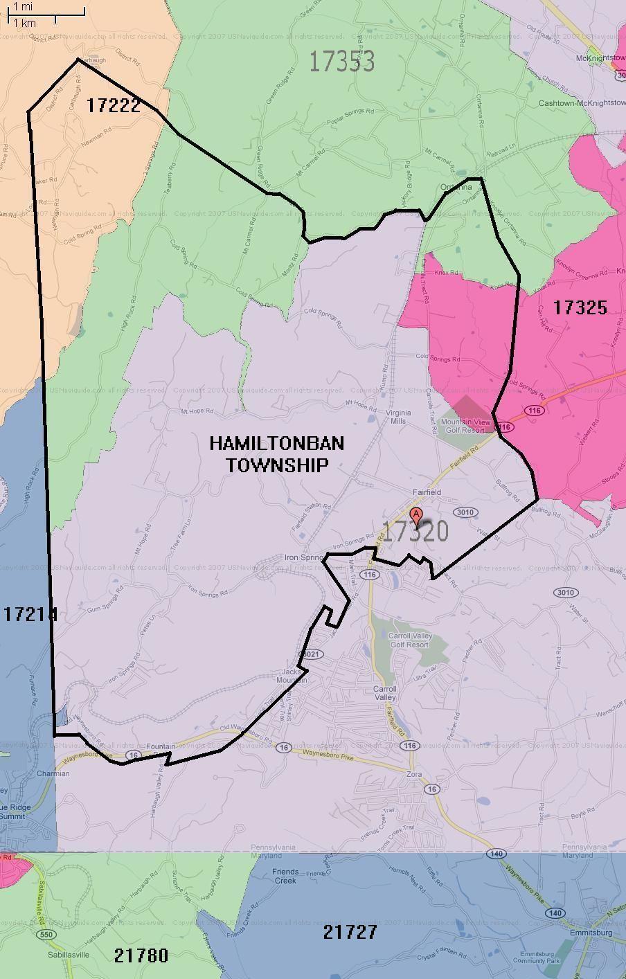
- Zip Code Boundaries (2008)
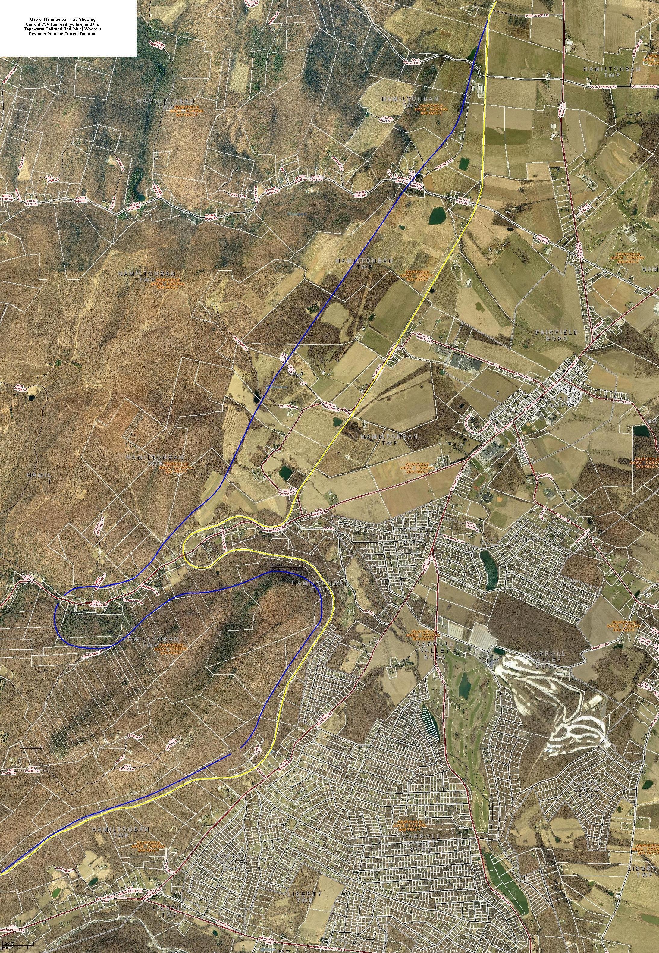
- Tapeworm Railroad Bed And CSX RR Tracks
- Zoning Map 2020
- Overlays 2020
- Riparian Buffers 2020
- Steep Slopes 2020
Maps
Interactive tax maps for all real estate parcels in Adams County

Interactive GIS Hub
Gallery of mapping apps, like the Parcel Viewer, storymaps, dashboards, and data for Adams County.
Recent Hamiltonban Township Maps
- Hamiltonban Township Official Map Narrative
- Hamiltonban Township Official Map
- Hamiltonban Township/Fairfield Borough Joint Recreation Plan Of 2008
- Southwest Adams Joint Comprehensive Plan/Adopted April 2015
- Open Space Plan-Text Only W/O Appendices
- Open Space Plan-Appendix B, Maps Of Potential Conservation Lands, Plate 1
- Open Space Plan-Appendix B, Maps Of Potential Conservation Lands, Plate 2
- Open Space Plan-Appendix B, Maps Of Potential Conservation Lands, Plate 3
- Open Space Plan-Appendix B, Maps Of Potential Conservation Lands, Plate 4